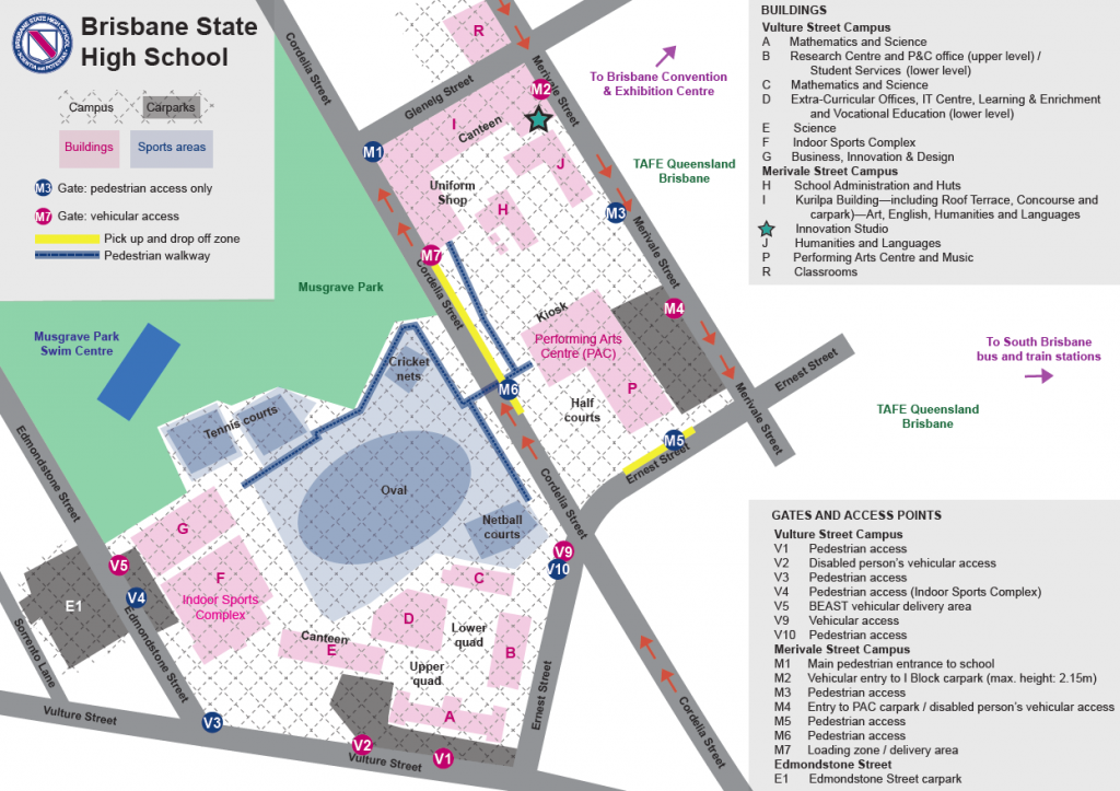
The school teaching facilities are located in South Brisbane and comprise two campuses, separated by Cordella Street. A pedestrian footbridge connects the two campuses providing safe passage for students, staff and visitors. The map below locates building on each campus and a downloadable map can be found here.
School Address:
Brisbane State High School Corner Cordelia and Glenelg Streets South Brisbane Qld 4101
Campus Map
Sports Fields – Fursden Road Carina
The school’s Sporting Complex is located at Carina and comprises 6 fields – which can also be configured as 4 cricket pitches, a canteen, amenities and sheds. A downloadable map can be found here.
 by BSHS P&C